5 Best Bike Trails in Salt Lake City
Utah is known for its mountain biking. Ok, maybe its best known for its world-class skiing, but just because the snow is gone, and the sun is out, doesn’t mean the fun has to stop. Salt Lake City has some excellent singletrack bike trails right in our back yard. The Wasatch Front has a little something for everyone from beginner trails overlooking the city, to epic, 30-mile excursions through high alpine mountains. Whether you’re a visitor or a local, you don’t have to drive all the way to Moab for some of the best mountain bike trails in the country.
1. Bonneville Shoreline
Best Bike Trail for Beginners
Skill level: Beginner/Intermediate
Length: Varies
Elevation: ~5000’-6000’
Elevation Gain: 100’-1466’
Distance from Downtown: 3.8 miles
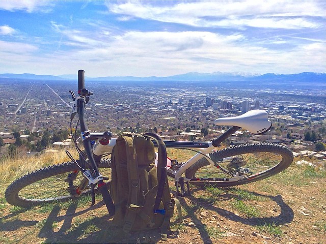
Bonneville Shoreline is the best mountain biking trail in the Salt Lake area for beginners and those looking for an easily accessible trail. Visitors to Salt Lake will find the views of the city and Wasatch mountains worth the short climb from the many entry points across the city. Bonneville Shoreline is actually a network of trails following the ancient shoreline from the Idaho border to Nephi. This trail can get hot in the summer, so go in the morning or catch a sunset overlooking the valley in the evening.
Directions: There are many locations to hop on the trail throughout the city, but an easy way to get there is from the capital building. From the Utah State Capital, head south on state street then east on South Temple. Head north on Virginia St, east on Popperton Parkway and follow to the end of the street.
More Information about Bonneville Shoreline Trail
2. Quarry Trail
Best Bike Trail for Quick Getaway
Skill level: Beginner/Intermediate
Length: 7 miles
Elevation: 5,463’-6,604’
Elevation Gain: 1,141’
Distance from Downtown: 21 miles
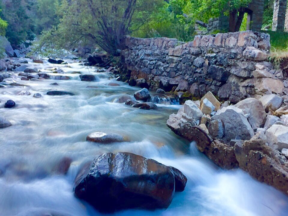
This out and back trail is very easy to get to – right at the base of Little Cottonwood Canyon. Quarry trail runs straight up the canyon to an old mill by the creek. Stop and relax by the creek before enjoying the downhill part of the ride. Don’t forget to look up at the granite walls surrounding you on the descent. If you’re looking for some quick fun close to town, this shaded trail is the perfect morning ride before the heat of the day.
Directions: Take I-15 south from downtown, head east on 215 before taking the Wasatch blvd exit to little cottonwood canyon. Just past the entrance to the canyon there is a right turn into the temple quarry trail parking lot.
More Information about Quarry Trail
3. Pipeline Trail
Best Bike Trail for Easy Views
Skill level: Beginner/Intermediate
Length: 13.3 miles
Elevation: 6,000’-6,700’
Elevation Gain: 700’
Distance from Downtown: 17.8 miles

Pipeline trail is located in Millcreek Canyon and offers beautiful views of the mountains and an overlook of the city below. This trail is just a few miles from Salt Lake City so you don’t have to spend all day trying to get to it. The easiest way to ride pipeline trail is to leave a car at Rattlesnake Gulch and take another up to Elbow Fork where the elevation is highest. From here it’s relatively flat or downward slopping all the way to the overlook. There’s a $3 service fee to use Millcreek Canyon and you should be on the lookout for dogs off-leash.
Directions: From downtown, take I-15 south to I-80-. Head east on I-80 and follow it to 215. Get off at the 3900 S exit and go east up Millcreek Canyon Road. Travel 5 miles up the canyon and the trailhead will be on the left at elbow fork.
More Information about Pipeline Trail
4. Deer Valley Resort
Best Bike Trail for a Downhill Mountain Biking
Skill level: Beginner/Intermediate/Advanced
Length: Varies
Elevation: 6,570’-9,570’
Elevation Gain: N/A
Distance from Downtown: 34 miles

If you’re looking for all the fun without any of the work, Deer Valley’s chairlift service is the option for you. This ski resort located in Park City offers nearly 70 miles of mountain biking in the summer with almost no uphill climbing. There are trails for all skill levels and beautiful views in every direction. You’ll find yourself banking turns through aspen groves and thick evergreen forests on this well-maintained network of trails. At 9000 feet elevation, this is the best option to beat the heat in the middle of summer. The chairlift runs June 14 to September 2 from 10 am to 5 pm.
Directions: From Salt Lake City head east on I-80 to Kimball Junction. Head south on 224 through Park City then make a left on Deer Valley Dr. Follow Deer Valley Drive 2 miles to the resort.
More Information about Deer Valley Resort
5. Wasatch Crest Trail
Best Bike Trail near Salt Lake City
Skill level: Intermediate/Advanced
Length: 12.5-24.7 miles
Elevation: 7,616-9,882
Elevation Gain: 900’
Distance from Downtown: 11 miles to shuttle

The Wasatch Crest trail is the most famous single track on the list, and for good reason. Riders have views in every direction from above Park City, Big Cottonwood Canyon, and Millcreek Canyon. High alpine ridgelines give way to aspen trees and fast banking turns on this legendary trail. The shuttle is the best way to experience this trail. Leave your car near the shuttle pickup at the base of Millcreek Canyon and enjoy the 30 minutes to Guardsman’s Pass. Riders be warned: there is an intense climbing section covering 350 vertical feet in half of a mile rightfully named Puke Hill. The rest of the ride is worth the climb as you descend 2000 feet into the canyon. Many riders hop on Pipeline Trail on their way down Millcreek Canyon and end up back at the shuttle stop.
Directions to Shuttle: From downtown, take I-15 south to I-80-. Head east on I-80 and follow it to 215. Get off at the 3900 S exit and the shuttle pick up is 3900 S and Wasatch Blvd. There is a second shuttle pick up at Mill D trailhead in Big Cottonwood Canyon.
More information about Wasatch Crest Trail